climb every mountain
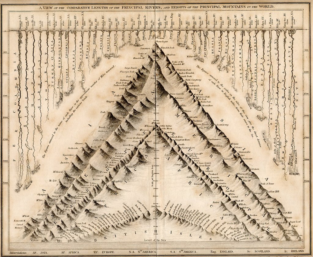
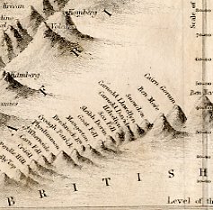
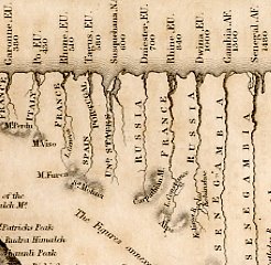
this is probably the oldest thing in the collection - an 1837 map titled "a view of the comparative lengths of the principal rivers and heights of the principal mountains of the world", published by john dower and william s. orr, who were highly respected mapmakers, printsellers, and publishers in early 19th century london. the beauty here is in the logic and the representation of it - flat images of rivers from a top view (looking like roots burrowing beneath an earthlike horizon line) whose lengths are compared to more rendered dimensional mountain forms(every mountain in the world stacked together); suggesting such profoundities as the length of the nile being equal to the height of the himaleh mountains. it's full of amazing detail, but also contains "some fascinating errors. dhaulagiri was considered the world’s greatest mountains (everest had yet to be measured) and the amazon the world’s longest rivers (the nile had yet to be mapped)". of course it also reminds me of alfred jensen...(click on the image of the whole map to see it big...)


1 Comments:
Beautiful!!!!!! I've just discovered this post trying to find an older reference to Rosa, which I was sure existed...
I have such an affinity for mountains that this is a very happy find...
I always think of the postman's gift of a map in Tarkovsky's The Sacrifice when I see something like this, such a rare find...
Post a Comment
<< Home